
The South 24 Parganas is bracing for a significant thunderstorm that is expected to sweep through the region shortly. Residents should prepare for potential lightning and rain, as weather forecasts indicate light to moderate rainfall alongside gusty winds reaching speeds of 30-40 km/h. A thunderstorm warning has been issued, highlighting the urgency of staying informed and safe amidst changing conditions. As rainfall predictions suggest localized downpours, keeping an eye on South 24 Parganas weather updates will be crucial for minimizing any adverse effects. With these atmospheric changes, it’s essential to heed the advice from local authorities and remain vigilant as the storm approaches.
As atmospheric disturbances develop, the South 24 Parganas district is set to experience intense weather activity characterized by severe rain and wind. This incoming storm, which brings with it the threat of electrical discharges and heavy precipitation, is likely to cause disruptions in daily life. The forecast predicts a steep increase in precipitation, along with brisk gusts that could affect mobility and safety in the area. Residents are encouraged to remain cautious and follow all storm-related advice to navigate these challenging weather conditions effectively. As the region faces this potential turmoil, understanding the implications of such climatic events becomes increasingly important.
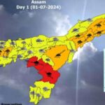
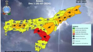
Thunderstorm Warning for South 24 Parganas
As of 11:10 AM on June 13, 2026, residents of South 24 Parganas district are advised to stay alert for an imminent thunderstorm warning. Meteorological forecasts indicate that light to moderate thunderstorms, accompanied by hazardous lightning and rainfall, are expected to affect various areas within the district. The storm is predicted to bring gusty winds with speeds reaching 30-40 km/h, which could pose risks to outdoor activities and structures in the vicinity.
The South 24 Parganas weather forecast highlights the potential impact of the upcoming thunderstorm. It is crucial for residents to prepare for possible disruptions, including power outages and road obstructions due to the intense rainfall. Local authorities urge individuals to adhere to safety guidelines issued by the State Disaster Management Authority (SDMA) to minimize risks during this weather event.
What to Expect During the Thunderstorm in South 24 Parganas
During the anticipated thunderstorm in South 24 Parganas, residents should prepare for possible severe weather conditions that include significant lightning strikes and accumulated rainfall. The gusty winds forecasted may also contribute to falling branches or debris, making it vital for individuals to remain indoors where safely possible. The area is expected to experience fluctuations in temperature and humidity levels, which can affect overall comfort.
Rainfall predictions suggest that the thunderstorm may lead to localized flooding, especially in lower-lying regions. This circumstances can further complicate transportation and access to essential services. Therefore, it’s prudent for the community to secure any outdoor items and be aware of the evolving weather situation, staying updated with the latest advisories from local meteorological services.
Safety Tips During Thunderstorms in South 24 Parganas
Given the forecasted thunderstorm in South 24 Parganas, it is vital for residents to follow certain safety tips to protect themselves and their families. First, avoid sheltering under trees, as lightning poses a grave risk. Seek refuge in sturdy buildings or vehicles instead. Additionally, refrain from using wired electronics and appliances during the storm to mitigate the chance of electric shock.
Preparing an emergency kit that includes essential supplies such as flashlights, batteries, and necessary medications can also be beneficial. Stay informed about weather updates through reliable sources, ensuring that you receive any thunderstorm warnings or advisories promptly. Being proactive can significantly enhance safety during this intense weather event.
Impact of Thunderstorms on Daily Life in South 24 Parganas
Thunderstorms can have a broad impact on daily life in South 24 Parganas. As heavy rainfall and strong winds sweep through the area, residents may face challenges such as transportation delays, especially in rural areas where road conditions may deteriorate quickly. Schools and businesses could also face closures, further affecting the local economy and day-to-day activities.
Moreover, the potential for flooding can lead to waterlogging in urban neighborhoods, affecting livelihoods and creating additional hazards. Community members are encouraged to stay connected and share information regarding safe routes and emergency contacts to navigate the situation effectively. Awareness and preparation are key factors that can help mitigate the effects of such severe weather disturbances.
Understanding Lightning and Rain During Thunderstorms
Lightning is one of the most dangerous aspects of thunderstorms, presenting a significant threat to life and property in South 24 Parganas. The intense atmospheric conditions that lead to thunderstorms can result in electrical discharges that can strike unexpectedly, causing fires or serious injuries. Staying indoors during such weather is the best protection against these risks.
Additionally, the rain accompanying thunderstorms usually varies in intensity, with some areas experiencing heavy downpours that can lead to flash flooding. Understanding how to read weather patterns and the specific warnings issued can prepare residents to respond accordingly, ensuring personal safety and reducing the likelihood of encountering hazardous situations.
Preparing for the Thunderstorm: Community Awareness
Community awareness and preparedness play a critical role in responding to thunderstorms in South 24 Parganas. Local authorities and disaster management bodies like the SDMA emphasize the importance of informing the public about potential dangers associated with thunderstorms, including enhanced risks of lightning strikes and flooding. Engaging community discussions and educational programs can help build a culture of preparedness.
Moreover, neighbors helping one another can foster a stronger sense of community resilience in the face of adverse weather. By sharing resources and information, residents can collectively prepare for thunderstorms and respond more effectively when they strike, ensuring that vulnerable populations are cared for and informed about best safety practices.
The Role of Meteorological Institutions in Thunderstorm Predictions
Meteorological institutions play a pivotal role in predicting thunderstorms and disseminating critical information to the public. In South 24 Parganas, regional meteorological departments continuously analyze weather patterns and utilize advanced technology to issue timely thunderstorm warnings. Their expertise allows local communities to receive accurate predictions and prepare for impending storms, thereby safeguarding lives and property.
These institutions collaborate with local government agencies to ensure effective communication of thunderstorm warnings and safety protocols. By actively monitoring atmospheric conditions and leveraging historical data, meteorologists provide valuable insights that inform emergency responses, helping to mitigate the impacts of severe weather on the South 24 Parganas district.
After the Thunderstorm: Assessing Damage and Recovery
Once a thunderstorm passes, the aftermath can leave behind significant challenges for South 24 Parganas. Assessing damage to homes, infrastructure, and the environment becomes a priority as community members begin the recovery process. Local governments and organizations often mobilize to evaluate the extent of damage and provide necessary resources to assist those affected.
Community resilience in the wake of thunderstorms is crucial for rapid recovery. Initiatives such as clean-up drives and financial aid programs can help restore normalcy to everyday life. Being part of recovery efforts enables residents to not only heal from the recent weather disturbances but also strengthens community bonds and enhances preparedness for future storms.
Staying Informed: Utilizing Technology for Thunderstorm Alerts
In today’s digital age, technology plays a vital role in keeping residents informed about weather conditions such as thunderstorms in South 24 Parganas. Various mobile applications and weather websites provide real-time updates on thunderstorm warnings, lightning activity, and rainfall predictions. Using these tools, individuals can receive alerts directly on their devices, making it easier to act swiftly during severe weather events.
Additionally, many organizations now offer SMS and email alerts, empowering the community to stay updated on weather emergencies. This technological advancement bridges gaps in communication, ensuring that everyone—regardless of access—can benefit from timely information. Emphasizing the importance of these resources can enhance overall awareness and preparedness against thunderstorms.
Frequently Asked Questions
What is the thunderstorm warning for South 24 Parganas today?
A thunderstorm warning has been issued for South 24 Parganas, predicting light to moderate thunderstorms, rain, and gusty winds of 30-40 km/h. This weather event is expected to occur within the next 2-3 hours, starting from 11:10 AM on June 13, 2026. Residents are advised to stay indoors and follow guidelines provided by the South 24 Parganas Disaster Management Authority (SDMA).
| Key Point | Details |
|---|---|
| Weather Event | Light to moderate thunderstorm with lightning. |
| Rainfall | Light to moderate rain expected. |
| Wind Speed | Gusty winds at speeds of 30-40 km/h. |
| Affected Area | Certain areas of South 24 Parganas district. |
| Time Frame | Expected within the next 2-3 hours from 11:10 AM on June 13, 2026. |
| Safety Guidelines | Follow the guidelines provided by SDMA. |
Summary
A thunderstorm in South 24 Parganas is projected to occur shortly, bringing with it light to moderate rainfall and gusty winds. This thunderstorm is expected to begin affecting various areas in the district in the next few hours, following the initial alert issued at 11:10 AM on June 13, 2026. Residents should remain vigilant and adhere to any guidelines set forth by the State Disaster Management Authority (SDMA) to ensure safety during this weather event, which could also include lightning hazards.